
Are Property Lines on Google Maps Accurate?
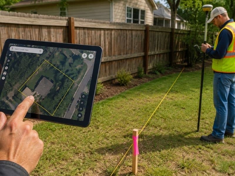
The short answer is no. Google Maps does not show accurate property lines. The boundary lines you see on Google Maps or Google Earth are pulled from public GIS (Geographic Information System) databases maintained by county tax offices. These records are meant for general reference only, and they carry no legal weight. If you are making decisions about your land based on what you see in Google Maps, you could be setting yourself up for a costly mistake.
What Does Google Maps Actually Show?
When you zoom into a property on Google Maps, you may notice faint lines outlining what looks like your lot. Many people assume these are their official property lines. In reality, they are rough approximations pulled from county tax assessor and GIS records.
These databases were not designed for land surveying. They exist to help government offices track property ownership for tax purposes. The data is often digitized from older plat maps, and counties update it at different rates. Some areas refresh their GIS records regularly, while others may go years without corrections. By the time that data reaches Google Maps, it can be significantly out of date.
Why These Lines Cannot Be Trusted
There are three main reasons why Google Maps property lines are not reliable for legal or construction purposes.
The data is not survey-grade. A professional land survey uses precision instruments such as GPS receivers and total stations to measure land with centimeter-level accuracy. GIS parcel data does not come close to that level of precision. The lines in Google Maps are digitized estimates, not field measurements.
The information is often outdated. If a property was subdivided, re-platted, or had a boundary change recorded, that update may not appear in the county GIS database for months or even years. Google Maps simply reflects whatever the county has on file, including errors.
It has no legal standing. No court, title company, lender, or building department will accept a Google Maps screenshot as proof of a property boundary. The only document that legally defines where your property begins and ends is a survey prepared and sealed by a licensed professional land surveyor.
How Far Off Can the Lines Be?
The error can range from a few feet to several dozen feet, depending on the area and the age of the records.
In urban and suburban neighborhoods, Google Maps lines might look close to correct but could still be off by 2 to 10 feet. That may not sound like much, but a 5-foot error near a property line can mean the difference between a legal fence and an encroachment on your neighbor’s land.
In rural areas, errors are often larger. Older properties described by metes and bounds, a method that uses directions and distances rather than a standard grid, are especially prone to misrepresentation in GIS systems. Errors of 20 to 50 feet are not unusual for rural parcels.
The Risks of Relying on Google Maps
Using Google Maps to make decisions about your property can lead to serious problems. Here are the most common issues homeowners face:
- Fence and structure encroachments. Building on land you believe is yours, but is not, can result in removal orders and legal disputes with your neighbor.
- Permit denials. Building departments require structures to meet setback requirements measured from legal property lines. Google Maps lines are not accepted for this purpose.
- Failed real estate closings. Buyers and lenders require accurate surveys before a sale is finalized. A Google Maps printout will not satisfy that requirement.
- Neighbor disputes. Assumptions based on Google Maps frequently lead to disagreements that require surveyors or attorneys to resolve, which adds time and expense.
The Right Way to Find Your Property Lines
The only reliable and legally recognized way to find your property lines is to hire a licensed professional land surveyor to perform a boundary survey.
A boundary survey involves researching your deed, reviewing recorded plat maps, locating existing survey monuments in the field, and using precision equipment to measure and confirm your property corners. At the end of the process, the surveyor will mark your corners with physical monuments such as iron pins or concrete posts. You will also receive a survey map that can be recorded with your county.
This is the document that holds up in court. It is what your title company, lender, and building department will accept. No online tool or satellite image can replace it.
When Should You Order a Boundary Survey?
You should consider getting a boundary survey in these situations:
- Before purchasing a piece of land or vacant property
- Before building a fence, shed, garage, or addition near your property line
- When a neighbor questions where your boundary is
- When applying for a building permit that requires setback documentation
- When dividing or selling part of your land
- When resolving a title issue during a real estate transaction
Frequently Asked Questions
Can I use Google Earth instead of Google Maps for property lines?
No. Google Earth uses the same GIS parcel data and has the same limitations. Neither platform provides legally accurate boundary information.
Are county GIS websites more accurate than Google Maps?
County GIS portals are often more current than Google Maps, but they are still administrative records, not survey-grade data. They should not be used for construction, legal, or real estate decisions.
How much does a boundary survey cost?
Costs vary based on parcel size, terrain, and the complexity of the deed description. Most residential boundary surveys in the United States range from $500 to $2,500. Contact Bridgeport Land Surveying for a quote specific to your property.