FEMA Elevation Certificate for a Home Near a Creek or Low-Lying Road
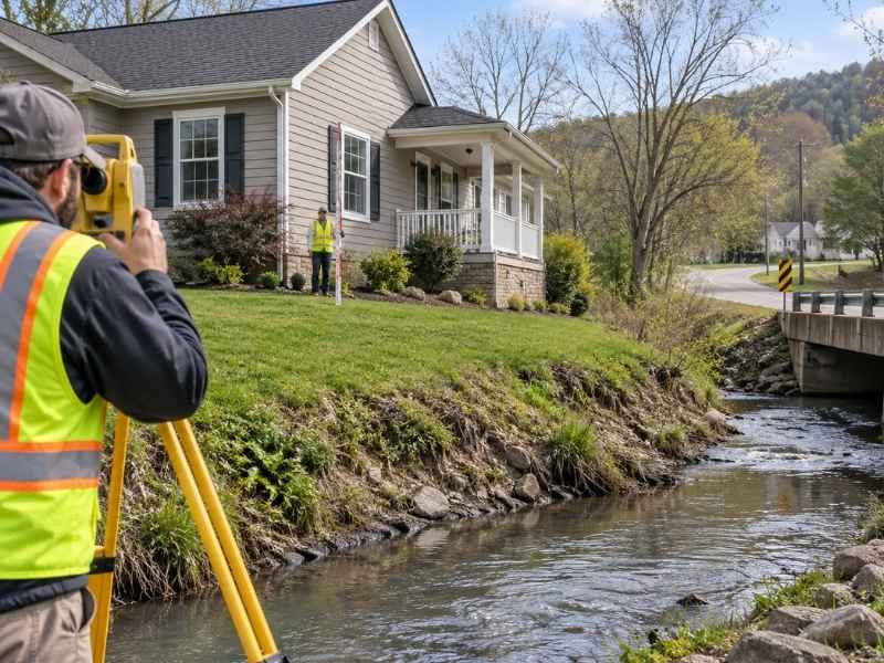
A home near a creek or a low stretch of road can look perfectly safe most of the year. Then one heavy rain changes the picture. Suddenly everyone wants to know how high the house actually sits.
A FEMA elevation certificate answers that question with real numbers. It records exact heights for a building and compares them to flood data for the area.
If you own or are buying a home near water, this document can affect your insurance costs, your closing timeline, and your peace of mind.
Why Nearby Creeks and Low Roads Raise Elevation Questions
A creek or a low road nearby does not always mean a home is at risk. But it does mean height becomes a fair question worth answering with facts instead of guesses.
Water follows the lowest path it can find. A home sitting close to a creek bank or downhill from a dipping road may sit lower than it looks from the street.
Bridgeport sits along waterways that have shaped growth for decades. Some neighborhoods have homes built well before today’s flood maps and elevation rules existed. Older homes near these areas are exactly where height questions tend to come up.
Common reasons someone asks for an elevation certificate include:
- A lender requiring it for a flood insurance decision
- A homeowner questioning a flood zone label
- A buyer doing research before purchase
- A property owner disputing an insurance bill
A FEMA elevation certificate replaces guesses with real measurements a lender or insurer can actually use.
Measuring the Home Against Surrounding Ground Elevations
The heart of a FEMA elevation certificate is a set of exact measurements. A licensed surveyor measures the height of key points on the building and compares them to the ground around it.
This usually includes the lowest floor height, the top of the foundation, and other reference points required by FEMA’s standard form. These measurements get tied to a fixed reference point called a datum. This keeps elevation data consistent across different surveys and properties.
Why Ground Elevation Context Matters
A building’s height only tells part of the story without knowing the ground height around it. A home might have a tall first floor but still sit in a low area where water collects during heavy rain.
Surveyors usually record:
- Lowest floor height of the building
- Height of the ground right next to the building
- Height of any attached garage or lowest enclosed space
- Reference points used to set the datum
These measurements form the facts behind everything else the certificate reports.
How Road and Creek Elevations Affect Site Context
A home’s height means little on its own. Comparing it to nearby things like roads and creeks gives that number real meaning.
A low road near a property can show that the general area has drainage problems during heavy rain. A nearby creek’s normal water level, along with its banks and flood channel, helps show how much room exists between normal conditions and a flood.
Several neighborhoods sit near creeks where seasonal rain and melting snow can raise water levels fast. Comparing a home’s height to these nearby features helps answer a simple question: how much room exists before water becomes a real concern for this home.
This context does not replace official flood zone rulings, but it does help homeowners and buyers understand why a property sits in a certain flood zone.
What the Elevation Certificate Records About the Structure
A finished FEMA elevation certificate records specific details about the building itself, not just what is around it. This part of the form creates a clear record of how the building was built compared to flood risk.
Information usually recorded includes:
- The height of the lowest floor used for living space
- Whether the home has a basement, crawlspace, or slab foundation
- The height of machinery and equipment that serves the building
- Flood vents or openings, if the building has any
This information matters because flood insurance costs and floodplain rules often depend on these exact details, not just a general sense of where the property sits.
Lenders and insurance companies rely on this recorded information to make coverage and rate decisions. Getting it right at this stage protects the homeowner from disputes later.
When the Findings Require Further Floodplain Review
Sometimes an elevation certificate turns up findings that need more review beyond the certificate itself. This does not mean something is wrong. It just means more information may be needed before insurance or permit decisions can move forward.
Situations that often lead to more review include:
- A building whose lowest floor sits close to the base flood height
- A property near a mapped flood channel instead of a general flood zone
- Recent construction or additions that were not shown in older flood data
- Differences between the certificate and existing flood zone maps
Floodplain review steps and rules can vary by city, county, and lender. Confirm with the right local office what extra steps might apply to your situation. If your closing or insurance timeline depends on answering these questions, start this process as early as you can.
Frequently Asked Questions
What is a FEMA elevation certificate?
A FEMA elevation certificate is a document that records exact height measurements for a building. It compares them to flood zone data for the area. It is often used for flood insurance and floodplain rules.
Do I need an elevation certificate if my home has never flooded?
It depends on your situation. Lenders often require one for flood insurance no matter the flooding history, especially for homes in or near mapped flood zones.
How does an elevation certificate affect flood insurance costs?
Insurance companies often use the recorded height data to figure out premiums. A building with a lowest floor well above the base flood height may qualify for lower rates than one closer to that line.
